 vesseltracker.com
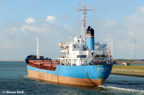
Vessel MAYA S IMO: 7926095, MMSI: 677038500 General Cargo
UTC, 39.77219, 26.09465, course: -1, speed: 8.8
UTC, 39.96691, 26.14239, course: -1, speed: 7.5
2026-03-04 17:49:24 UTC, 40.11806, 26.37532, course: -1, speed: 8.3
Live Vessel MAYA S Analytics (details, animations, etc.)
Live AIS position: UTC. Near Akcansa), updated 2026-03-04 17:49:24 UTC.Find the position of the vessel MAYA S on the map. The latter are known coordinates and path.
marine traffic ship tracker show on live map
The current position of vessel MAYA S is 40.11806 lat / 26.37532 lng. Updated: 2026-03-04 17:49:24 UTCCurrently sailing under the flag of Tanzania
Details:
Last coordinates of the vessel:
UTC, 39.43954, 25.89566, course: -1, speed: 8.6UTC, 39.77219, 26.09465, course: -1, speed: 8.8
UTC, 39.96691, 26.14239, course: -1, speed: 7.5
2026-03-04 17:49:24 UTC, 40.11806, 26.37532, course: -1, speed: 8.3